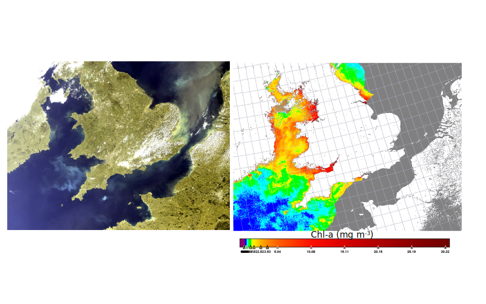
Ocean color remote sensing technology is quite mature and algorithms have been developed to estimate from space the concentration of algal and non-algal particles in aquatic environments (i.e. ocean and lakes). Today this technology has many applications related to coastal sediment transport or environmental monitoring. However, very significant errors from atmospheric correction and sunglint removal algorithms are a major cause of low or unusable quality data. Many approaches are being investigated to achieve improvements, among them, the use of multi-look satellite data has potentially great value.

Whereas all dedicated “ocean colour” sensors currently flying (MODIS, OLCI, VIIRS, etc..) provide data for only a single viewing direction, there are a number of satellite missions for which multi-look data is available and is relevant for aquatic applications including Pléiades, CHRIS-PROBA and Sentinel-3/SLSTR and for certain regions, SEVIRI. While all optical remote sensing algorithms currently use only spectral information, the optical probing of water in different directions provides extra information on the atmosphere, air-water interface and aquatic particles that could be used to improve atmospheric correction and sunglint removal.
The AQUALOOKS project aims to improve data quality and quantity for sediment transport and phytoplankton-related applications to correct Bidirectional Reflectance Distribution Function (BRDF). AQUALOOKS project is also expected to improve our understanding of BRDF of atmosphere, air-water interface and water.

The AQUALOOKS project (SR/00/374) is funded by BELSPO (Belgian Science Policy Office) in the frame of the STEREO III programme
The AQUALOOKS project is carried out by a consortium consisting of: RBINS (coordinator), VLIZ and FAU.
