RAdCor performance is currently under evaluation using in situ measurements collected by Castagna et al. 2022 in the BELSPO/STEREO PONDER and HYPERMAQ projects.
This update shows a comparison of the standard ACOLITE/DSF and newly developed ACOLITE/RAdCor processing of OLI and MSI imagery with in situ measurements made in the Spuikom, Oostende, Belgium on 2018-04-19.
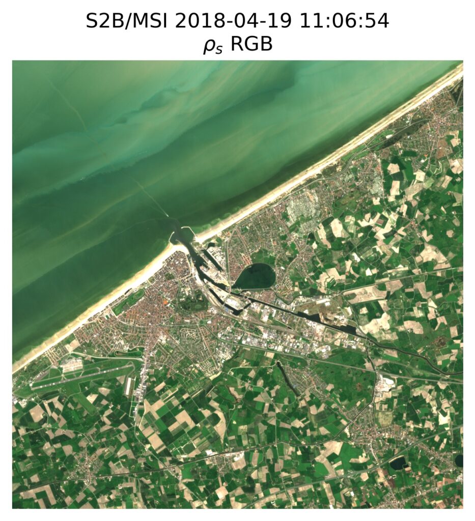
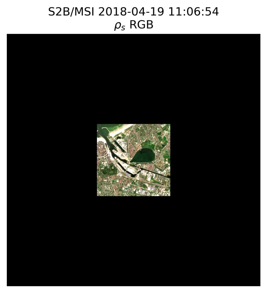
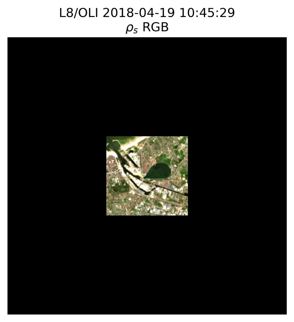
The following images show typical ρs RGB composites after processing with DSF (left) and RAdCor (right). Both are processed with a 14 x 14 km region of interest centred on the Spuikom, and a 5 km radius for the atmospheric point spread function (PSF) is used in the RAdCor processing. The black borders in the RAdCor image are a masking for areas where the atmospheric PSF coverage falls outside of the image borders. This masking indicates where the highest quality processing will be achieved, i.e. in the centre of the image, fully covered by the PSF. A close examination shows improved sharpness of the image after RAdCor processing. (Although this may be less obvious after image compression on the website.)
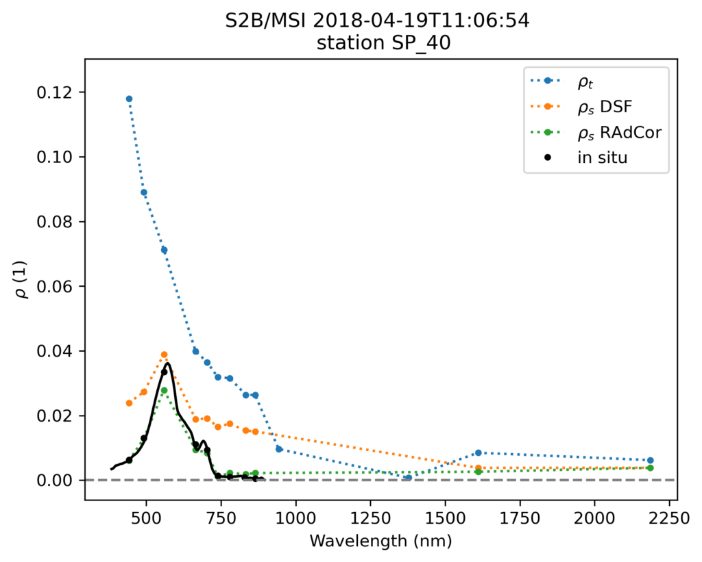
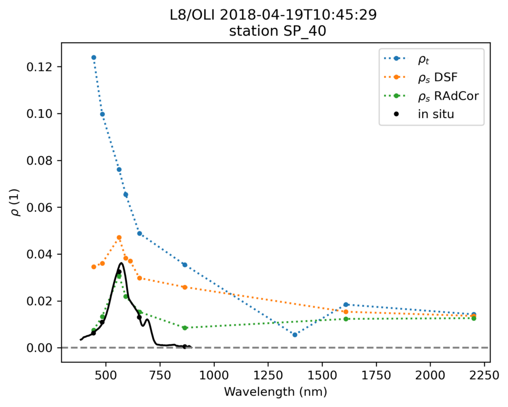
A hyperspectral in situ measurement was made in the middle of the Spuikom at around 10:45 UTC, and is here convolved to the spectral response of the sensor. This matchup reveals the marked improvement of the RAdCor (green) processing over DSF (orange) processing, especially in the blue, red, and near-infrared bands.
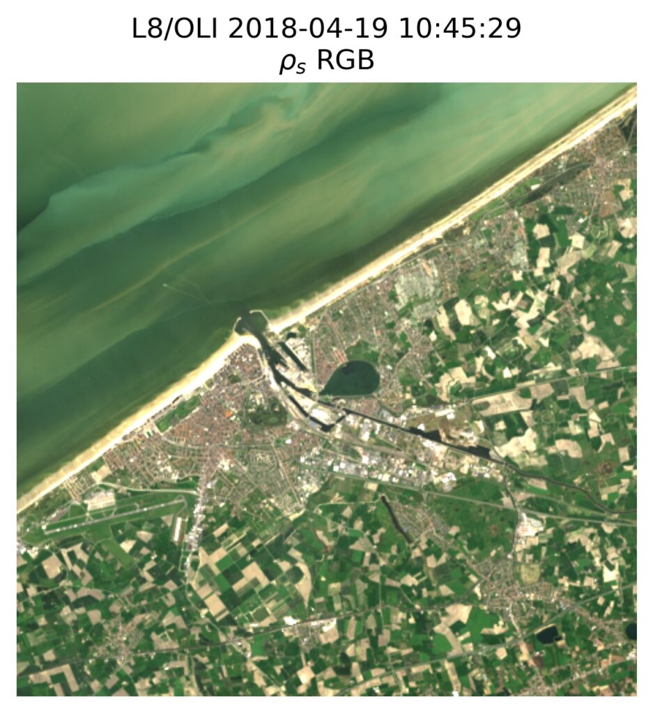
A similar result is achieved for a Landsat 8 scene taken about 20 minutes earlier.
A similar performance improvement of RAdCor over DSF is achieved for the visible bands. Note that both RAdCor and DSF processing also output the panchromatic channel centred at around 592 nm.
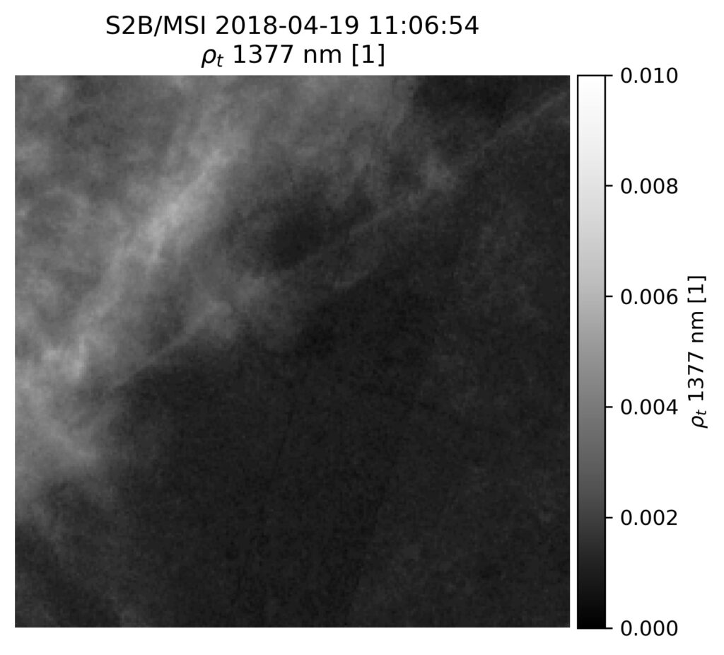
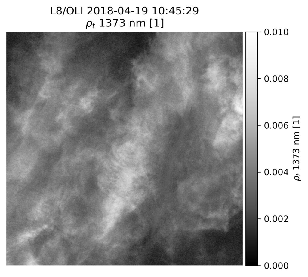
The near-infrared band still shows a relatively large deviation from the in situ measurement for Landsat 8, which is mostly caused by the presence of cirrus clouds. These are largely transparent in the visible, but show increased reflectance in the near-infrared, and especially in the cirrus band. A comparison of the cirrus band reflectance between Sentinel-2 and Landsat 8 indicate the presence of a cirrus cloud over the Spuikom on the latter, i.e. ρt at around 1375 nm is practically 0 during on the Sentinel-2 image, while it is >0.005 on the Landsat 8 image.
Leave a Reply