Study Areas
PONDER focuses on three study areas:
1) Belgian coastal waters
TThe mapping of suspended sediment concentration in the Belgian ports is an important driver for this research. The Belgian coastal zone is very turbid, and regular dredging is needed to keep the ports accessible. Very high resolution sediment concentration maps can aid in hydrodynamic model validation. Validation data for the atmospheric correction will be collected at the Zeebrugge/MOW1 and Thornton/CPower AERONET-OC sites.
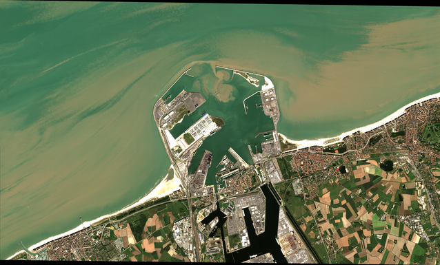 Figure:
Small scale sediment transport in the port of Zeebrugge. Captured by Pléiades-1A on 8 September 2014 (11:10 UTC).
Figure:
Small scale sediment transport in the port of Zeebrugge. Captured by Pléiades-1A on 8 September 2014 (11:10 UTC).
2) Belgian inland waters
Time series of in situ measurements of pigment concentration, turbidity and water clarity will be collected at four lakes in Belgium:
- Donkmeer, Berlare,
- Spuikom, Oostende, and
- Hazewinkel, Mechelen.
Acquisition of multiple images from the Pléiades constellation will aid the understanding of the
ecological processes in these lakes. The performance of the satellite will be evaluated and specific retrieval algorithms will be designed.
The suitability of Pléiades for macrophyte mapping will be evaluated.
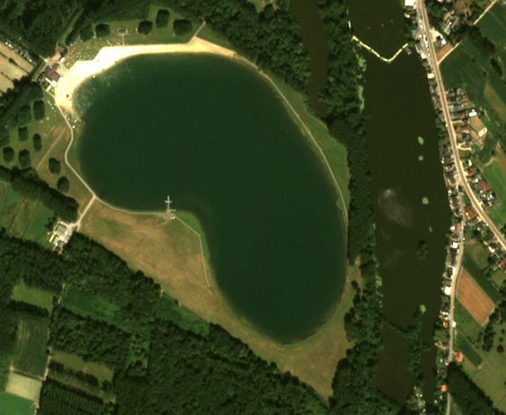 Figure: Example image covering the Nieuwdonk and part of the Donkmeer study area in Berlare.
Captured by Pléiades-1A on 21 July 2013 (10:54 UTC). Image data obtained from the Belgian Pléiades
Archive
(url=http://pleiades.busoc.be/).
Figure: Example image covering the Nieuwdonk and part of the Donkmeer study area in Berlare.
Captured by Pléiades-1A on 21 July 2013 (10:54 UTC). Image data obtained from the Belgian Pléiades
Archive
(url=http://pleiades.busoc.be/).
3) French coastal waters and rivers
The Gironde and Rhône rivers are two important sources of suspended sediments on the French Atlantic and Mediterranean coasts respectively. There is a strong interest of high resolution suspended sediment maps for dredging monitoring and ecosystem modelling. Validation data will be collected from autonomous systems, and Pléiades data will be used to generate high resolution sediment concentration maps.
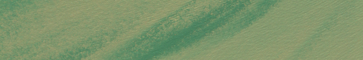
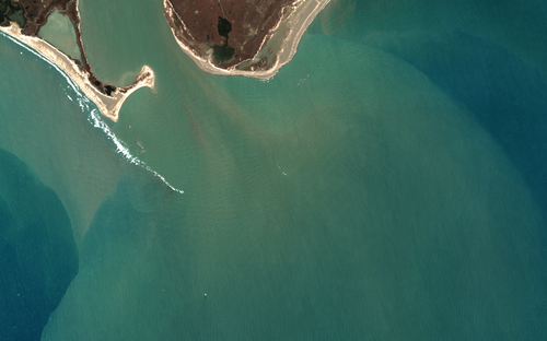 Figure:
The Rhône river plume in the Western Mediterranean Sea. Captured by Pléiades-1B on 28 February 2015 (10:42 UTC).
Figure:
The Rhône river plume in the Western Mediterranean Sea. Captured by Pléiades-1B on 28 February 2015 (10:42 UTC).