TEST SITES
The HYPERMAQ project is based on different test sites from inland and coastal waters
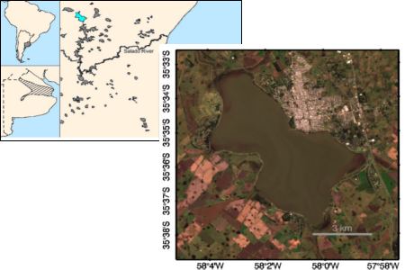
Chascomus Lake (Argentina)
 Location
Latitude: 35º 35’ S / Longitude: 58º 01’ 10’’ W
DescriptionThe Chascomús Lake is a typical water body in the Pampa region of Argentina, part of the “chained” lakes. It’s a relatively large (~30 km2), permanent, and shallow (mean depth of 1.53 m) lake. It is an eutrophic, turbid, shallow water body which is permanently mixed by the persistent wind shear and which transparency is mainly controlled by suspended particles where both phytoplankton and non-pigmented particles contribute in a similar way to total absorption.
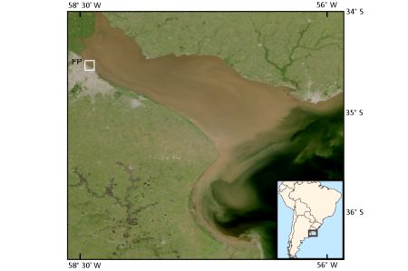
Rio de la Plata upper estuary (Argentina)
 Location
Latitude: 34º 33’ 39’’ S / Longitude: 58º 23’ 56’’ W
DescriptionThe Río de la Plata Estuary is one of the largest waterways of South America carrying large amount of suspended particulate and dissolved orgamatter, and is considered among the most turbid waters of the world. Very high values of total suspended matter have been reported in this region, with mean values ranging from 100 to 300 g m-3 and extreme concentrations up to 400 g m-3.
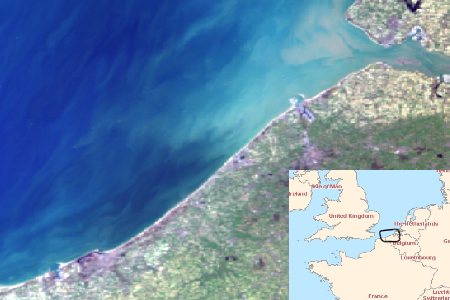
Belgian coastal waters
 Location
Latitude: 51º 19’ N / Longitude: 2º 47’ E
DescriptionBelgian coastal waters are shallow and display a high variability in terms of sediments and phytoplankton. Surface sediment patterns are influenced by tide, vertical mixing (resuspension) and sediment transports from Strait of Dover and Yper and Sheldt rivers. Phytoplankton blooms are generally observed from spring to summer and can be dominated by different species such as diatoms, Phaeocystis or dinoflagellates.
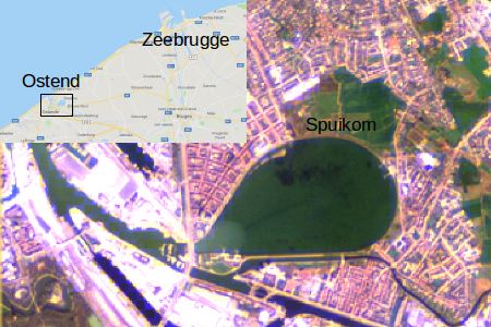
Spuikom (Belgium)
 Location
Latitude: 51º 13’ 41’’ N / Longitude: 2º 57’ 10’’ E
DescriptionSpuikom is a shallow artificial lagoon with a surface of 80 ha located near Ostend harbor (Belgium). It is mainly used for aquaculture and recreational activities. Chlorophyll concentration ranges between 20 to 200 mg m-3 during strong bloom events. Macroalgae can also be present in Spuikom basin. In particular, Ulva blooms are used as an indicator of the ecological status of the basin.
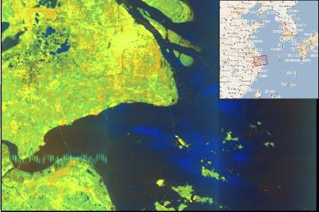
Changjiang estuary (China)
 Location
Latitude: 31º 20’ N / Longitude: 122º 50’ E
DescriptionThe Changjiang River estuary is located at the junction of the East China Sea and the Yellow Sea, on the continental shelf at the western Pacific Ocean. The Changjiang River estuary and its adjacent area is a very turbid and productive aquatic ecosystem.
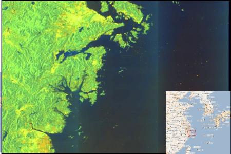
Zhoushan island (China)
 Location
Latitude: 29º 55’ N / Longitude: 122º 50’ E
DescriptionThe adjacent area of Zhoushan island is a famous upwelling area in the East China Sea, with huge runoff of the Changjiang, Qiantang and Yongjiang rivers bringing abundant nutrition to Zhoushan island area.
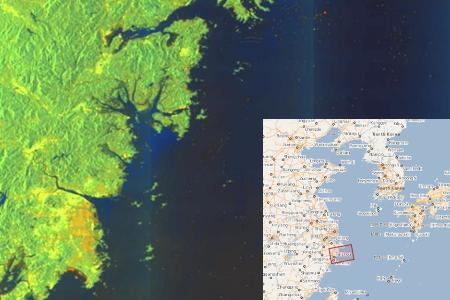
Zhejiang coast (China)
 Location
Latitude: 28º 55’ N / Longitude: 122º 01’ E
DescriptionThe Zhejiang coast is an important part of East China Sea. The hydrological condition of this area is complicated in summer, with diluted water of Changjiang river from north and Taiwan warm current from south.
Gironde estuary (France)
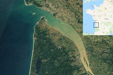 Location
Latitude: 45º 28’ 58’’ N / Longitude: 0º 54’ 10’’ W
DescriptionThe Gironde Estuary is located on the French Atlantic coast. It is characterized by a turbidity gradient mainly impacted by tidal currents.
Rhone river mouth (France)
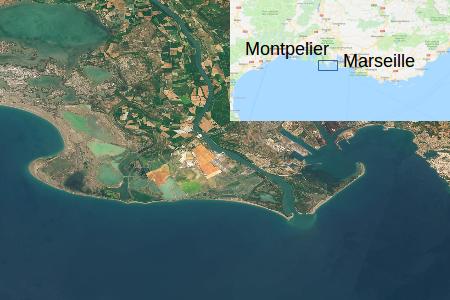 Location
Latitude: 43º 19’ 09’’ N / Longitude: 4º 51’ 15’’ W
DescriptionThe Rhone River mouth is located in the North-Western Mediterranean Sea with turbid waters showing a strong seasonality due tu changes in river discharge and only slightly impacted by tidal currents.