Study Areas
Multi-Sync focusses on two study areas in the Belgian Coastal Zone:
S3plus and GEO Imagery of the complete Belgian coastal zone with a focus on the harbour Zeebrugge and the C-Power offshore wind farm for which S2plus data will be acquired. The radiometric validation of ocean colour data in a multi sensor perspective will be based on two Belgian AERONET-OC sites, one in turbid nearshore waters (Zeebrugge-MOW1) and one further offshore in clearer waters (Thornton-CPower). Water leaving radiance data products acquired at high temporal resolution (i.e. 30 min time intervals) by the CIMEL-SeaPrism system are transmitted on a daily basis to the AERONET-OC center managed by NASA for near real time processing after which they are posted on the AERONET-OC data portal (https://aeronet.gsfc.nasa.gov). The Belgian AERONET-OC stations have been operational are part of REMSEM’s long term vision on ocean colour product validation and will be maintained and kept operational during the MULTI-SYNC project.
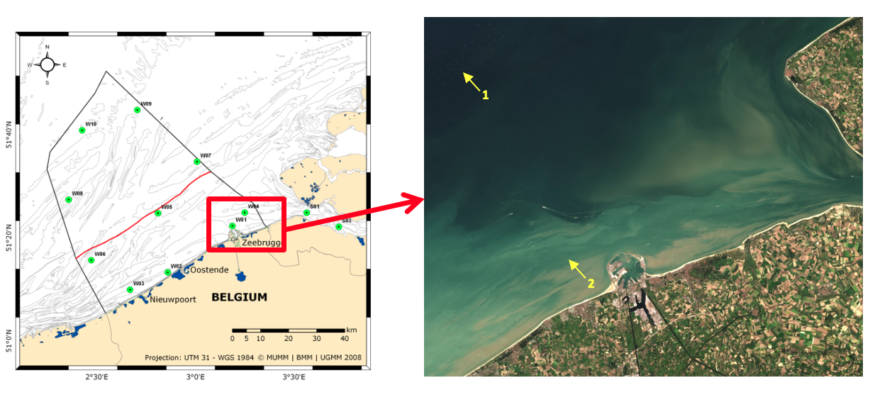 Figure:
(left) Belgian waters and (right)the location of the two AERONET-OC sites: 1) Thornton-CPower and
2) Zeebrugge-MOW1 shown on a RGB composite from Landsat-8 on 2.9.2015 generated using ACOLITE.
Figure:
(left) Belgian waters and (right)the location of the two AERONET-OC sites: 1) Thornton-CPower and
2) Zeebrugge-MOW1 shown on a RGB composite from Landsat-8 on 2.9.2015 generated using ACOLITE.
The Thornton-Cpower site is installed on the Offshore Transformation Station (OTS) of the C-power windpark located 26 km offshore in 19m water depth. The SeaPrism is installed on the upper platform rail corner and has been actively collecting ocean color data since April 2015.
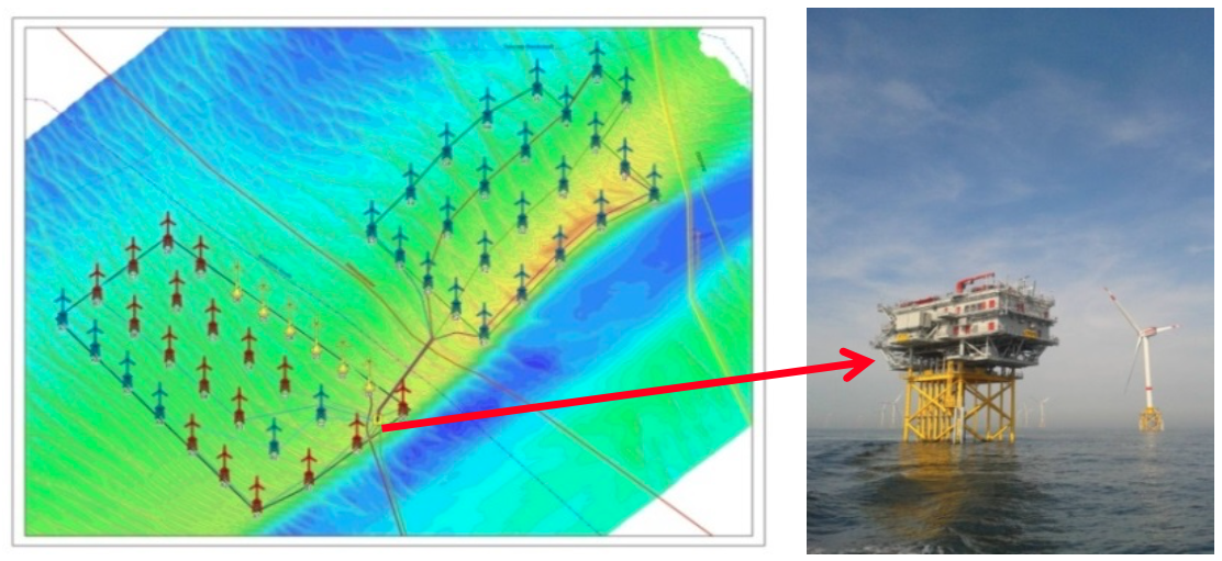 Figure:
(left) C-Power wind farm on the Thronton bank with (right) the offshore transformer station on which the AERONET-OC stations is mounted.
Figure:
(left) C-Power wind farm on the Thronton bank with (right) the offshore transformer station on which the AERONET-OC stations is mounted.
The Zeebrugge-MOW1 station is mounted on a measurement pole near the Zeebrugge harbour in 10m water depth, 3.65km from land. The SeaPrism instrument is installed on the platform rail. The system has been actively collecting ocean colour data since February 2014.
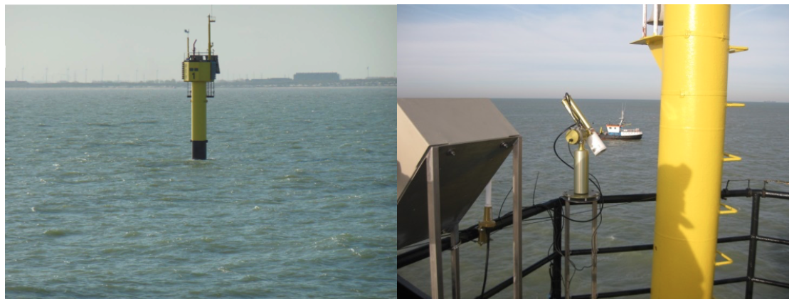 Figure:
(left) Measurement pole ‘MOW1’ near Zeebrugge with the (right) AERONET-OC station installed on the platform rail.
Figure:
(left) Measurement pole ‘MOW1’ near Zeebrugge with the (right) AERONET-OC station installed on the platform rail.