Introduction
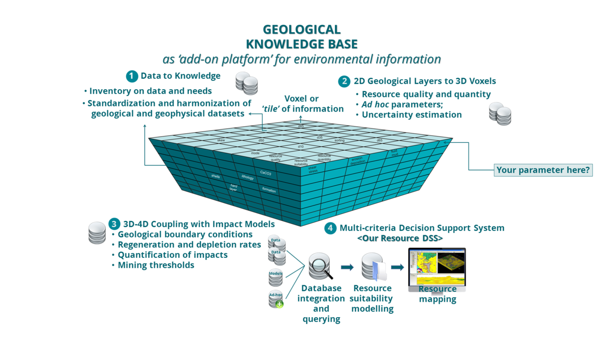
TILES was devoted to the creation of a harmonized geological knowledgebase of the Belgian and southern Dutch part of the North Sea. Most innovatively, the geological resource was quantified in 5 dimensions: space, depth, time, and associated uncertainties. A decision support system now functions as a critical platform for the exchange of data, information and knowledge. This is key within the European Union's ambitious Marine Strategy Framework Directive (MSFD) aiming at protecting more effectively the marine environment across Europe.
Read more:
Subject and objectives Societal relevance International context Workpackages References